

You can find on this page the Kyoto topographic map to print and to download in PDF. The Kyoto elevation map present the topography, river and relief of Kyoto in Kansai - Japan.
The Kyoto topographic map shows elevation, hills and landforms in Kyoto. This elevation map of Kyoto will allow you to know topography, river and relief of Kyoto in Kansai - Japan. The Kyoto topographic map is downloadable in PDF, printable and free.
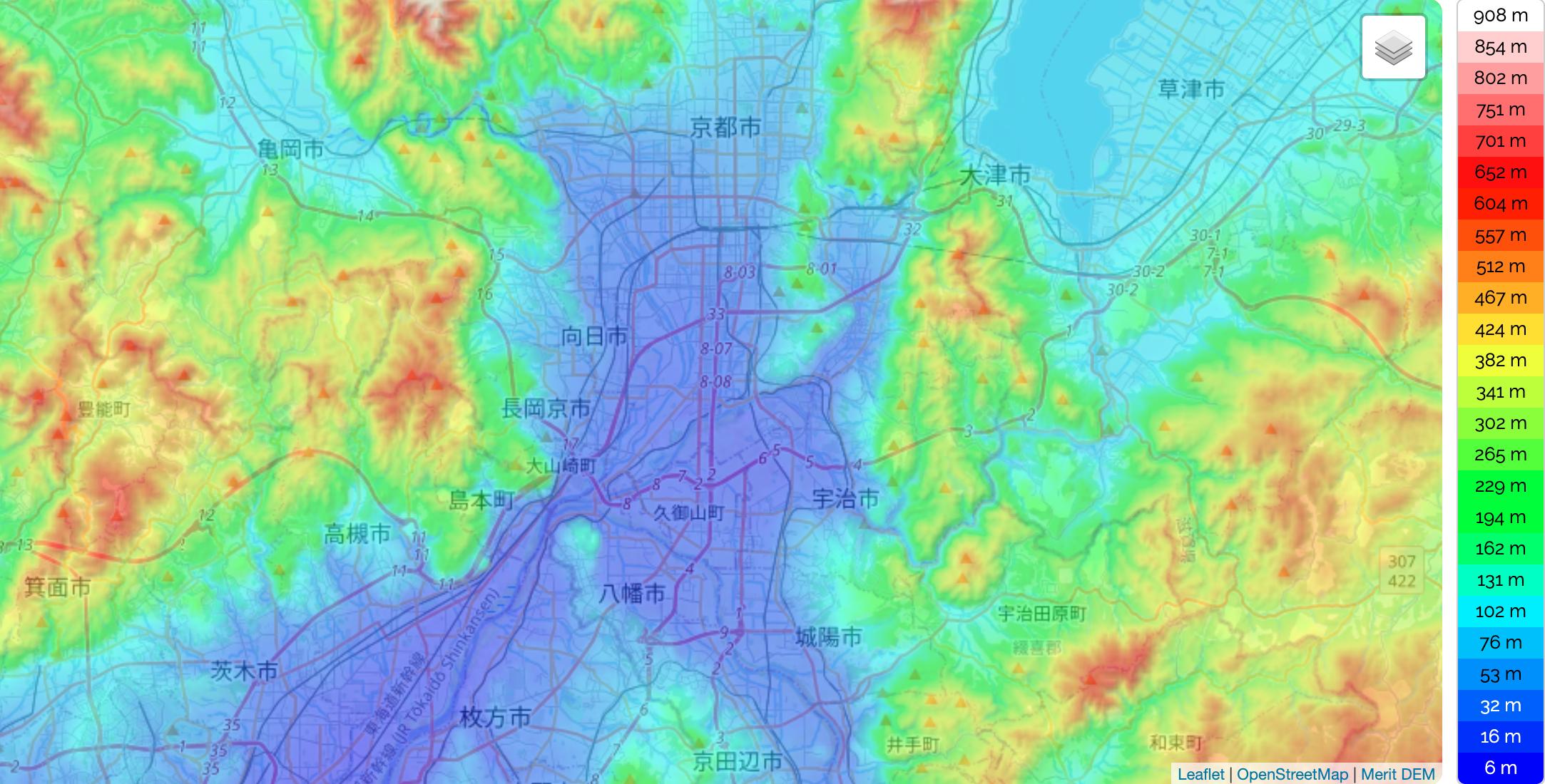
Kyoto is located in a valley, part of the Yamashiro (or Kyoto) Basin, in the eastern part of the mountainous region known as the Tamba highlands. The Yamashiro Basin is surrounded on three sides by mountains known as Higashiyama, Kitayama and Nishiyama, with a height just above 1,000 metres (3,281 ft) above sea level as you can see in Kyoto elevation map. This interior positioning results in hot summers and cold winters. There are three rivers in the basin, the Ujigawa to the south, the Katsuragawa to the west, and the Kamogawa to the east. Kyoto City takes up 17.9% of the land in the prefecture with an area of 827.9 km².
Designated the site of a new capital by the emperor Kammu, Kyōto was laid out in 794 on the model of Chang’an (modern Xi’an), the capital of China Tang dynasty. The plan called for a rectangular enclosure with a grid street pattern, 3.2 miles (5.1 km) north to south and 2.8 miles (4.5 km) east to west. The Imperial Palace, surrounded by government buildings, was in the city north-central section. Following Chinese precedent, care was taken when the site was selected to protect the northern corners, from which, it was believed, evil spirits could gain access. Thus, Hiei-zan (Mount Hiei; 2,782 feet [848 metres]) to the northeast and Atago-yama (Mount Atago; 3,031 feet [924 metres]) to the northwest were considered natural guardians as its shown in Kyoto elevation map. Hiei-zan especially came to figure prominently between the 11th and 16th centuries, when warrior-monks from its Tendai Buddhist monastery complex frequently raided the city and influenced politics.
Heian site in Kyoto was chosen for its easy river and road access, auspicious topography, and strategic mountain and river defenses. Mount Hiei is the most prominent of the mountains around Heiankyo, 848 meters high as its mentioned in Kyoto elevation map. An object of mountain worship in ancient times, it became the main center of Buddhism when temples were erected there to guard the northeast direction of the capital.